Tuesday, April 25, 2006
Creepy faults
Actually the title ought to be "creeping faults", but that's not nearly as catchy. This past weekend I went on a field trip to the creeping section of the San Andreas fault. The creeping section of the San Andreas extends from Parkfield to the south to San Juan Bautista to the north. That section of the fault is odd because instead of moving through a series of stops and jerks (i.e., earthquakes), it creeps. In other words instead of leaping ahead by many meters during a large earthquake it just inches along. The sections of the San Andreas to the north and south of the creeping section generate very large earthquakes. The section to the north generated the 1906 San Francisco earthquake. The section to the south generated an even larger quake in 1857 called the Fort Tejon quake.

The photo above shows the mission at San Juan Bautista. It's taken from a scarp along the San Andreas. This town marks the southern extent of the portion of the fault that ruptured during the 1906 earthquake, and as I said earlier it marks the northern part of the creeping section of the San Andreas fault.

The cracks in this freshly-paved road (Highway 25 south of Hollister, California) are caused by creep along the Calaveras fault (a fault related to the San Andreas).

The curb in this photo, located in the town of Hollister, has been offset by creep along the Calaveras fault. The offset is by the woman toward the top of the photo.

Photos of fences that were offset during earthquakes (like this one) are fairly common. However, that's not how this fence was offset (the offset occurs near the telephone pole in the middle of the picture). This fence, located just off of Highway 25 south of the Pinnacles, was offset by the creeping San Andreas.

The image above shows a stream channel that's been offset as it crosses the San Andreas fault. As the channel hits the fault it bends away from the man in the red jacket toward the man in the blue jacket. This channel is ~ 15 miles south of the town of Parkfield just off of Highway 46. This location is near the northernmost portion of the San Andreas the ruptured during the 1857 event (and that also marks the souther boundary of the creeping San Andreas).

The bridge in this photo leads to Parkfield, which despite its small population (the sign currently reads 18) is one of the better-known places along the San Andreas. It's been intensely studied for decades because the fault there generates earthquakes fairly regularly (you can read more about that here). The kink in the railing has been caused by creep along the fault as the Pacific plate moves north relative to the North American plate.

A much-anticipated earthquake occurred in the Parkfield area in 2004. The photo above shows a pylon supporting the Parkfield bridge that moved during that event (the offset is shown by the silver mechanical pencil). That motion didn't occur immediately during the earthquake; it occured after it as the fault crept much faster than normal. This sort of motion is unsuprisingly called "postseismic motion." It doesn't occur after every earthquake, but it is fairly common. In fact some fault have preseismic motion. Unfortunately that's not universal either, so it can't be used to predict earthquakes (although a warning system in Japan is based on that idea).
There's still a lot about the ways in which faults move that we don't understand. Of course, all that means is that it's a great time to study faults!
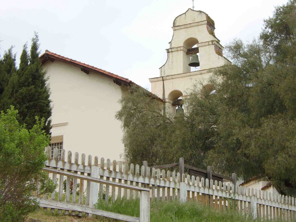
The photo above shows the mission at San Juan Bautista. It's taken from a scarp along the San Andreas. This town marks the southern extent of the portion of the fault that ruptured during the 1906 earthquake, and as I said earlier it marks the northern part of the creeping section of the San Andreas fault.

The cracks in this freshly-paved road (Highway 25 south of Hollister, California) are caused by creep along the Calaveras fault (a fault related to the San Andreas).

The curb in this photo, located in the town of Hollister, has been offset by creep along the Calaveras fault. The offset is by the woman toward the top of the photo.
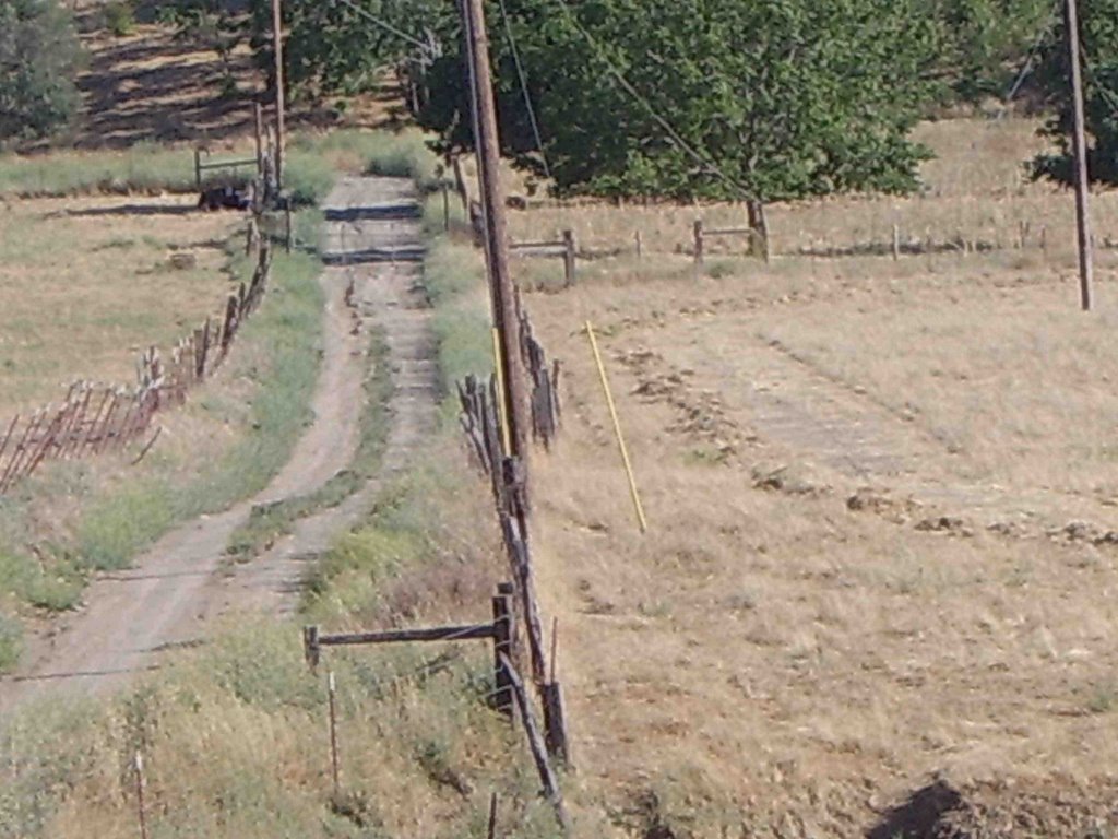
Photos of fences that were offset during earthquakes (like this one) are fairly common. However, that's not how this fence was offset (the offset occurs near the telephone pole in the middle of the picture). This fence, located just off of Highway 25 south of the Pinnacles, was offset by the creeping San Andreas.
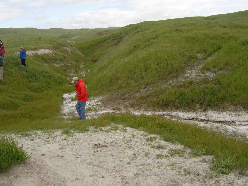
The image above shows a stream channel that's been offset as it crosses the San Andreas fault. As the channel hits the fault it bends away from the man in the red jacket toward the man in the blue jacket. This channel is ~ 15 miles south of the town of Parkfield just off of Highway 46. This location is near the northernmost portion of the San Andreas the ruptured during the 1857 event (and that also marks the souther boundary of the creeping San Andreas).

The bridge in this photo leads to Parkfield, which despite its small population (the sign currently reads 18) is one of the better-known places along the San Andreas. It's been intensely studied for decades because the fault there generates earthquakes fairly regularly (you can read more about that here). The kink in the railing has been caused by creep along the fault as the Pacific plate moves north relative to the North American plate.
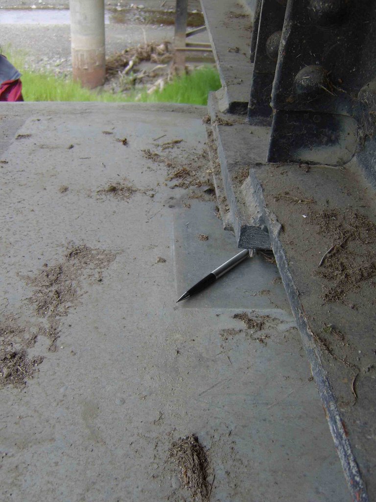
A much-anticipated earthquake occurred in the Parkfield area in 2004. The photo above shows a pylon supporting the Parkfield bridge that moved during that event (the offset is shown by the silver mechanical pencil). That motion didn't occur immediately during the earthquake; it occured after it as the fault crept much faster than normal. This sort of motion is unsuprisingly called "postseismic motion." It doesn't occur after every earthquake, but it is fairly common. In fact some fault have preseismic motion. Unfortunately that's not universal either, so it can't be used to predict earthquakes (although a warning system in Japan is based on that idea).
There's still a lot about the ways in which faults move that we don't understand. Of course, all that means is that it's a great time to study faults!
![]()